


In the digital age, maps are no longer neutral tools for navigation; they are dynamic platforms shaped by data policies, regional sensitivities, and political pressure. Nowhere is this more visible than in the Middle East, where long-standing territorial disputes and ongoing conflicts influence how places are labeled, omitted, or represented online. Digital mapping platforms such as Apple Maps and Google Maps have repeatedly found themselves at the center of geopolitical controversy.
Southern Lebanon’s Missing Labels
Amid Israel’s ongoing invasion of Lebanon, a post by independent journalist Ethan Levins, highlighting the discrepancy on X (formerly Twitter), has accused Apple Maps of de-emphasizing towns in the country’s south.
Screenshots shared online suggested that certain border communities, such as Bint Jbeil, Aita Ash-Shaab, Naqoura, and Maroun El Ras, were either missing labels or appeared less prominently compared with rival mapping services.
“Persian Gulf” vs “Arabian Gulf” Dispute
Naming disputes are among the most enduring geopolitical tensions reflected in digital maps. One of the most prominent examples involves the body of water internationally known as the Persian Gulf.
Google Maps has previously faced criticism for displaying the term “Arabian Gulf” alongside or instead of “Persian Gulf” in certain regions or search contexts. The naming dispute reflects long-standing regional disagreements: Iran insists on the historical name “Persian Gulf,” while several Arab states promote the term “Arabian Gulf.”
The issue gained renewed attention amid US–Iran diplomatic tensions and nuclear negotiations last year, as regional governments continued to push for terminology that aligns with their political narratives.

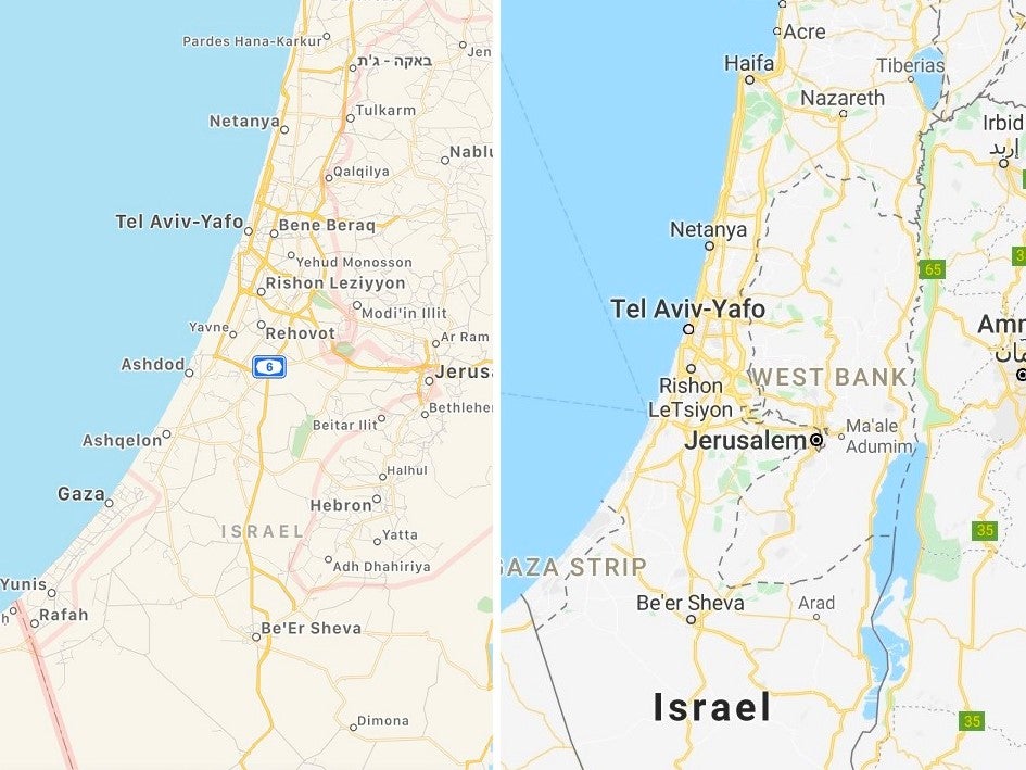
Palestine’s Recognition on Digital Maps
Another deeply contentious case involves the representation of Palestine on Google Maps. Users have long observed that searching for “Palestine” often results in an outlined area without a clear country label, while Israel remains fully labeled. This has sparked criticism from those who argue that the absence of a formal label undermines Palestinian statehood claims.
The issue is complicated by international recognition: while 136 United Nations member states recognize Palestine as an independent state, countries such as the United States and many Western governments do not. As a result, Google’s mapping approach reflects a cautious, policy-driven balance between differing diplomatic positions rather than a universally agreed geographic classification.
Digital maps were once seen as objective representations of geography, but in reality, they are curated systems influenced by political pressure, corporate policy, and regional disputes. Whether through missing town labels in conflict zones, disputed sea names, or contested state recognition, platforms like Apple Maps and Google Maps illustrate how geography itself can become politically negotiated in the digital era.
We Said This: Don’t Miss… FBI Director’s Email Breached by Iran-Linked Hackers: What’s the Bigger Picture?