


The Middle East is one of the most historically and culturally rich regions in the world. It’s the birthplace of many different civilizations, and it witnessed some of the most important events in the world’s history. The region is interesting yet complex to study and understand. One way to know and understand the region more is by looking at the historical maps that came out of the Middle East and provide insights into how rulers, astronomers and scientists saw the world.
We’ve compiled some of the most important historical maps that came out the Middle East, from Ancient Egyptian star charts to Islamic depictions of the world. If you find this topic interesting, you should definitely delve in and read more about each of them, and of the many other maps that showcase how people viewed the world throughout different ages.
Babylonian Map of the World
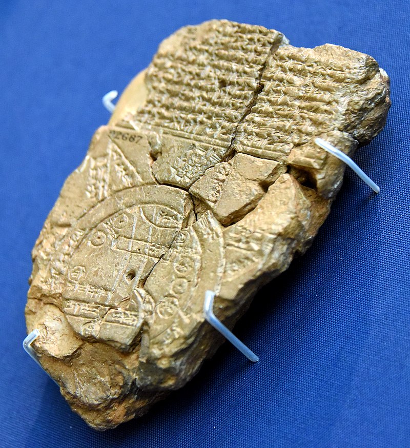
The Babylonian Map of the World is a Babylonian clay tablet containing a labeled depiction of the known world, with a short and partially lost description, dated to roughly the 6th century BC. It was discovered at Sippar around 60 km north of Babylon. It was first translated in 1889, and it currently resides in the British Museum.
Turin Papyrus Map
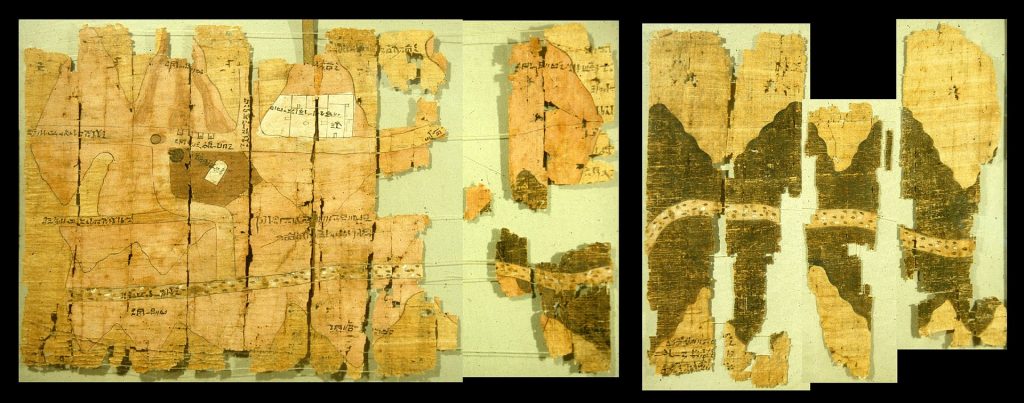
The Turin Papyrus Map is an ancient Egyptian map that’s generally considered the oldest surviving map of topographical interest from the ancient world. The map was drawn about 1150 BC by the well-known Scribe-of-the-Tomb Amennakhte, son of Ipuy. It is drawn on a papyrus reportedly discovered at Deir el-Medina in Thebes, collected by Bernardino Drovetti, in Egypt sometime before 1824 AD. For people who love origami, the map has been considered as the earliest known example of folding.
The Dendera Zodiac
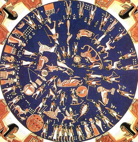
An amazingly preserved bas-relief in the portico of Hathor’s temple in Dendera, Egypt, showing an ancient zodiac and an ancient sky. The zodiac is a Ptolemaic planisphere, or chart of the stars, showing the 12 constellations that make up the zodiac’s star signs, some of which take their typical Greco-Roman forms, and some that take on the form of Egyptian deities and myths.
Balkhi World Map
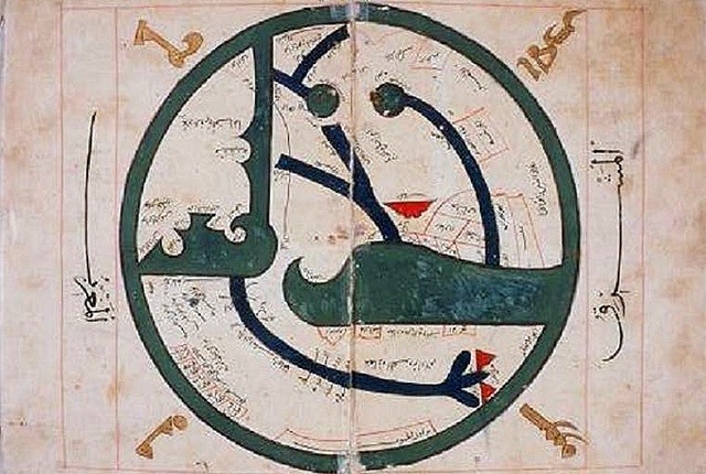
This map was displayed on “Old Manuscripts and Maps from khorasan” by Abu Zaid Ahmed ibn Sahlal-Balkhi (850-934). Abu Ziad is a Persian geographer who was a disciple of al-Kindi and also the founder of the “Balkhī school” of terrestrial mapping in Baghdad.
Astronomical ceiling of Senenmut’s Tomb
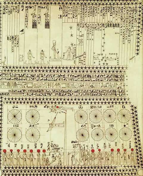
Astronomical ceiling decoration in its earliest form can be traced to the Tomb of Senenmut. located at the site of Deir el-Bahri, Egypt. The tomb and the ceiling decorations date back to the 18th Dynasty of ancient Egypt (ca. 1473 B.C.).The tomb of Senemut was discovered during the 1925-1927 excavations directed by Herbert Winlock for the Egyptian Expedition of the Metropolitan Museum of Art.
Horoscope from the book of the birth of Iskandar
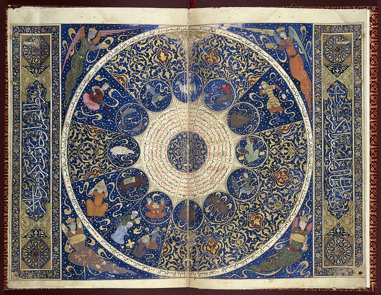
This horoscope shows the positions of the stars at the moment of Iskandar’s birth on 25th April 1384. This is a fly leaf from the personal horoscope of Iskandar Sultan (died 1415), grandson of Timur, who ruled the province of Farsin, Iran. The manuscript was bought in Iran in 1794 by John H. Harrington and in 1932, it was auctioned at Sotheby’s and bought by Sir Henry Wellcome who added it to his collection of Oriental books and manuscripts.
The Book of Curiosities Map
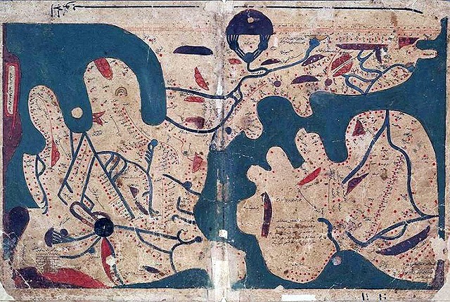
The Book of Curiosities is a highly illustrated treatise on astronomy and geography. The manuscript consists of five books and includes a number of diagrams depicting the Heavens and mapping the Earth. This manuscript is thought to have been composed in Egypt during the first half of the 11th century and was discovered recently by Emilie Savage-Smith, an expert in the field of Islamic Manuscripts.
Al-Idrisi’s World Map
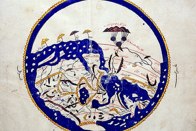
Al-Idrisi was a well-known 12th-century Muslim geographer, cartographer, and Egyptologist. He is responsible for one of the most famous maps appearing in the history of Muslim civilization.
Al-Rudani’ Astrolobe
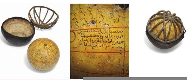
Al-Rudani was a 17th-century astronomer and scholar who was born in Morocco and died in Syria. He was known as a poet, mathematician, Hadith specialist, Quran Interpreter, and an Arabic Grammar specialist. The image above is one of only three known Al-Rudani spherical astrolabes. It was sold at an auction for close to $1 million!
