

In just 40 years, the population of the Middle East and North Africa has blossomed from 197 million to a staggering 472 million, with few signs of easing off any time soon. To accommodate and feed this exploding population, cities have sprawled out in all directions, new cities have sprung up in the desert, and fields have conquered the desert to grow crops. To catalogue these changes and more, we took a look at historical satellite images of the Middle East from over the last 40 years from 1982 to 2022 courtesy of Google Earth Pro to see how the Middle East and North Africa has and continues to change.
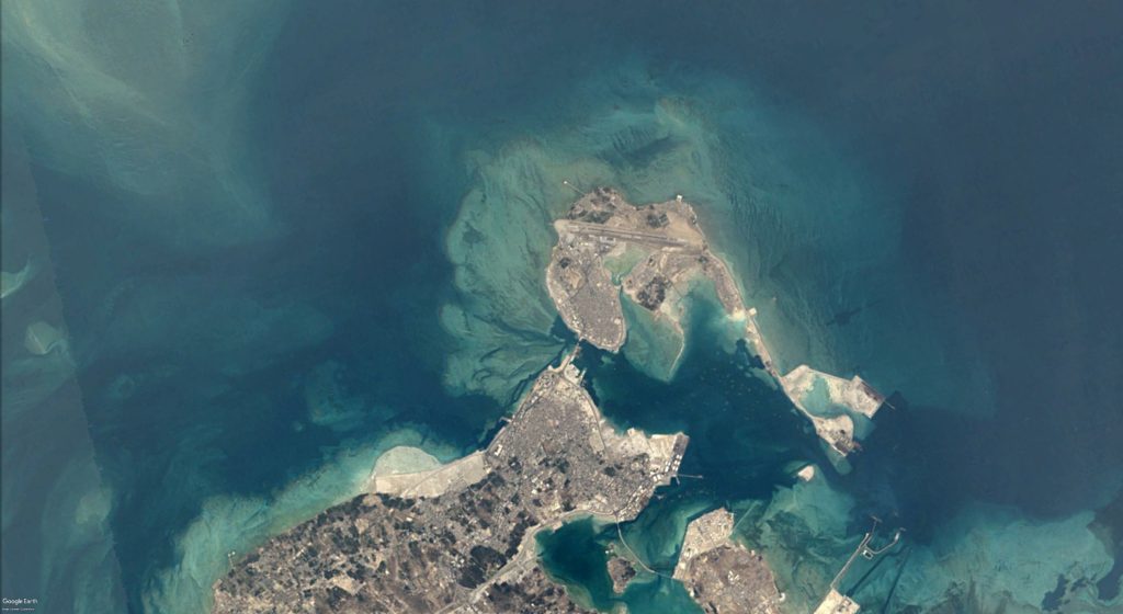
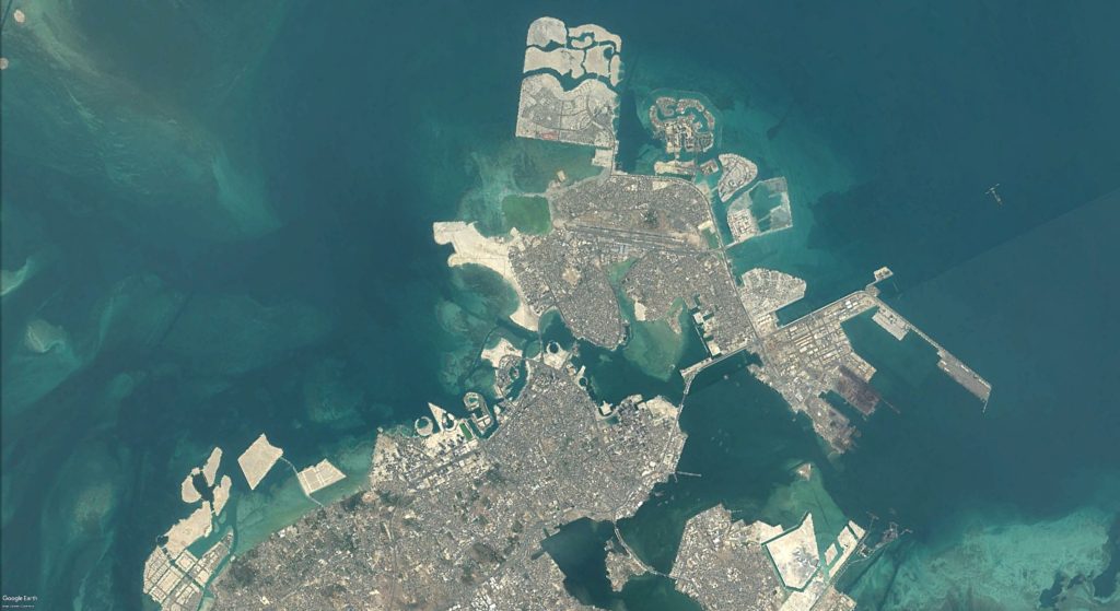
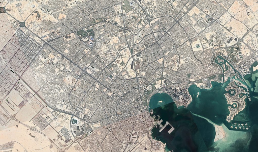
Building into the Sea in Bahrain
In Manama, the capital city of Bahrain, the city has extended not just into the city, but into the sea itself. As part of massive land reclamation projects, this tiny nation has created artificial islands and extended its coast to house luxury resorts and new industries.
The Flowering Egyptian Delta
The winding Egyptian Nile on a map, which flows through the desert with its lush green embankments before sprawling out and nourishing the Delta has often been described as looking akin to a flowering lotus flower. The small green stalk that opens up and has historically spread greenery to Port Said in the East and Alexandria in the West, however, seems to be unfurling further and spreading out its green reach into the Western Desert and into the East near Ismalia and Suez.
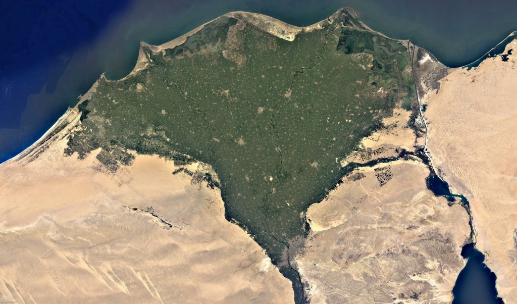
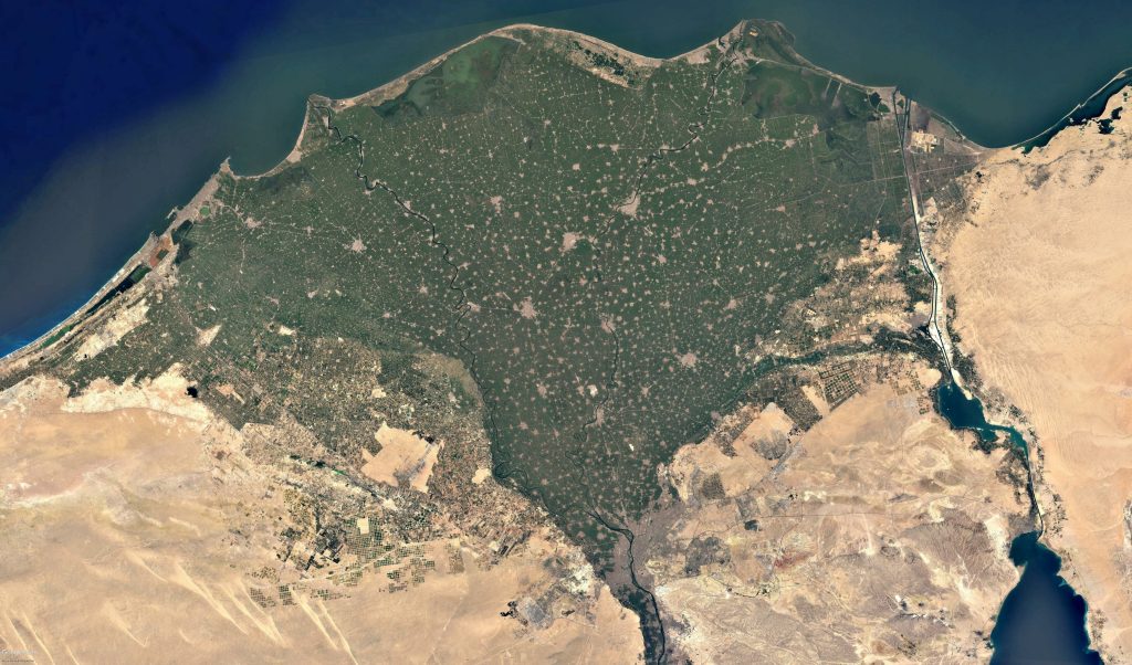
To feed Egypt’s growing population and improve the country’s food security and food self-reliance, land reclamation projects spearheaded by government initiatives have for the last few decades increasingly spread the Nile’s green reach into the desert.
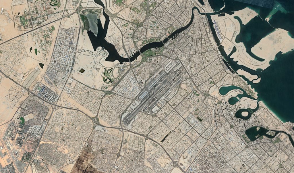
Dubai: The City Extravagant
At the turn of the twentieth century, Dubai was a small town housing around 10,000, but following the discovery of oil in 1966, the city’s population began to soar and it quickly became one of the world’s most well-known cities. In 1985, as shown in the below satellite image, Dubai was home to 370,000 people, but 37 years later in 2022, its population has almost increased ten times to 3.3 million. Of this 3.3 million, a mere 15% are UAE nationals, with the rest being made up of people from around the world that have moved to Dubai for work.
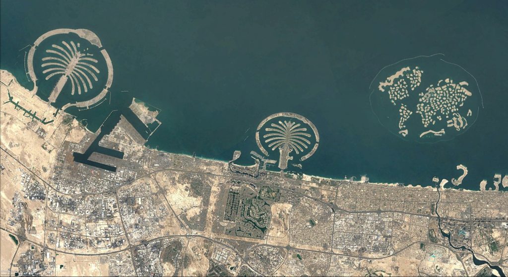
Although mistaken for still being an oil-dependant economy, Dubai’s economy has been thoroughly diversified as oil contributed to only 1% of Dubai’s GDP in 2018. Instead, tourism, financial services, real estate and industry now make up the bulk of the country’s revenue. This diversified economy can be seen in the expanse of city of Dubai, which now houses all matter of weird and wonderful constructions, the world’s largest skyscraper and huge artificial island developments among them.
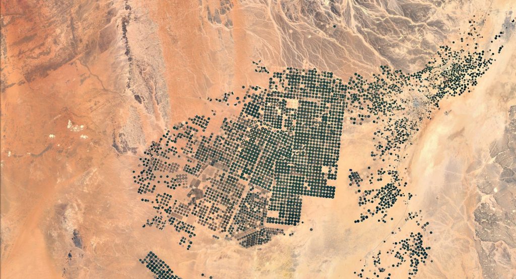
The Greening of Saudi Arabia
Saudi Arabia may have been blessed with the world’s largest oil reserves, yet it was not given much in the way in terms of arable land to grow crops. Using their large oil revenues and tapping their underground aquifers, Saudi Arabia has embarked on a colossal project of using circular farms to feed its population. These large farms made of hundreds of enormous circular farms can be clearly seen from space and stick out to the naked eye as a patch of green surrounded by the vast sands of the Gulf.
Apartheid as Seen From Space: The Gaza Strip
Depressingly, the occupation of Palestine can be seen from space. Described by Amnesty International as the ‘world’s largest open air prison’, the Gaza Strip houses two million Palestinians with a population density of 5046 persons per square kilometre, putting the Gaza Strip in the unenviable position of being the third most densely populated area in the world. With the continuing occupation and the booming population prevented from spreading outward, the outline of the Gaza Strip over the last four decades has become ever clearer and more depressing as housing has taken over the bulk of farmland and the population increasingly struggles to live in such a small area of land.

The border of the Gaza Strip has become even more visible from above in the last twenty years as Palestinian farmers with land bordering Israel were forced to abandon their land from 2006 all the way until 2020, leading to the complete degradation of once fertile soil. This policy was enforced in an incredibly violent manner, resulting in several farmers tending to their land being shot dead by the Israeli Defence Forces.
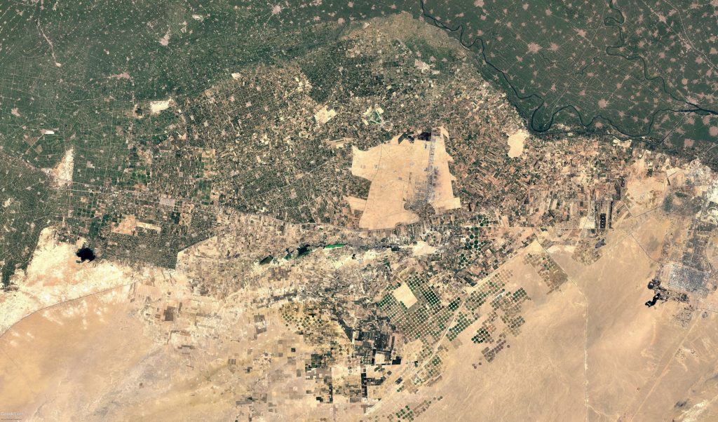
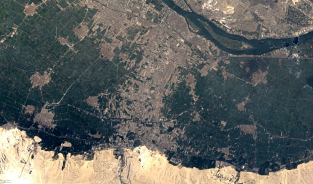
Cairo: City of a Thousand Minarets and 22 Million People
Cairo is a megalopolis. With nearly 22 million people in 2022 residing in Greater Cairo with a suffocating population density of 3249 Cairenes per kilometre square, Cairo has predictably spilled over into the desert in the East and West and into agricultural lands to the North and South.
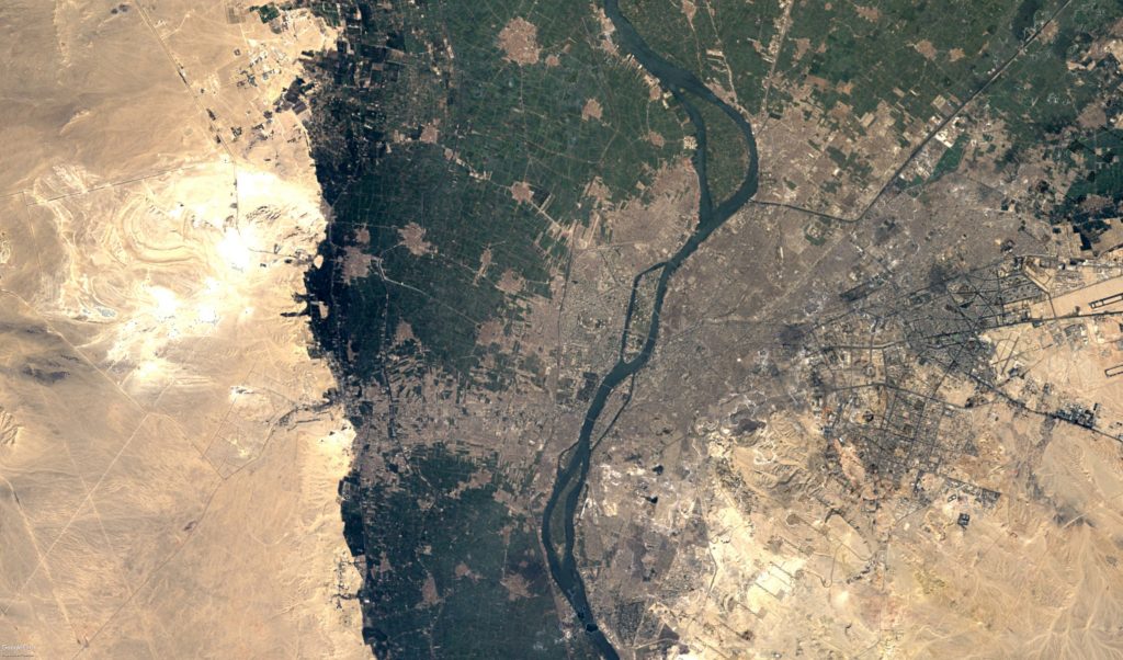
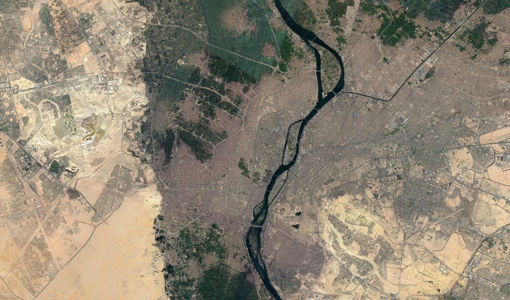
However, forty years ago in 1982, when the first satellite images were taken, Greater Cairo’s population was only 7.7 million, indicating an incredible increase of nearly 300% in just four decades.
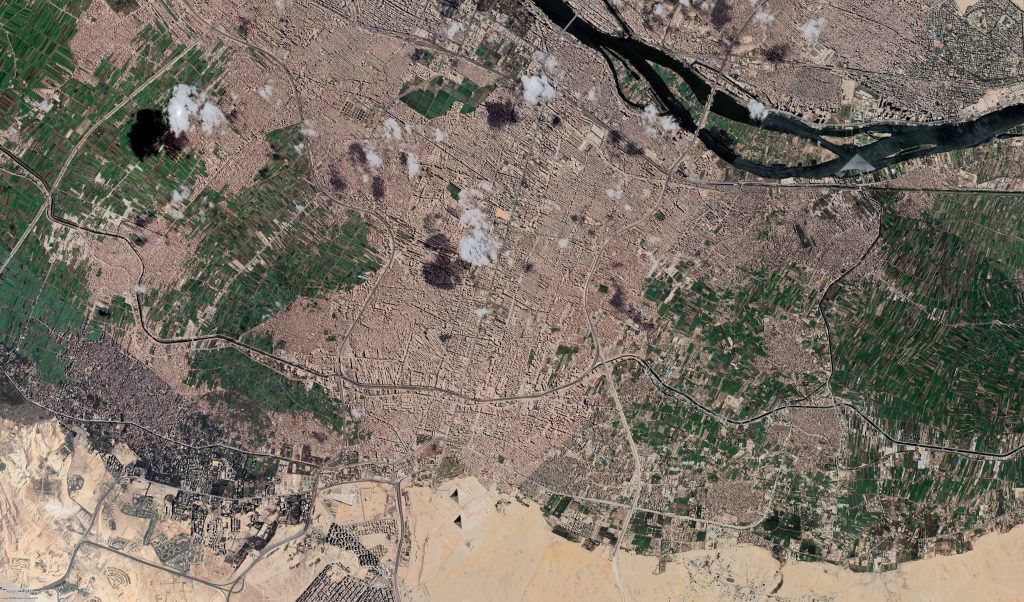
To put things in perspective, Greater Cairo now has the same population as three Lebanons and sixty Icelands. Greater Cairo also homes more people than many countries with large territories such as the Netherlands, Syria, Chile and Romania. To house these new residents, considerable government efforts have been into creating new desert cities to ease population density in central Cairo, but have only succeeded in housing 3.6% of Greater Cairo’s population, according to the 2006 Census.

While the Egyptian government is aiming to limit Greater Cairo’s population to no more than 30 million by 2050 in its Cairo Vision 2050 plan, UN Habitat state that according to current trends, the population is set to reach 38 million by 2050.
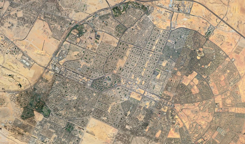
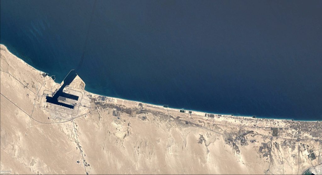
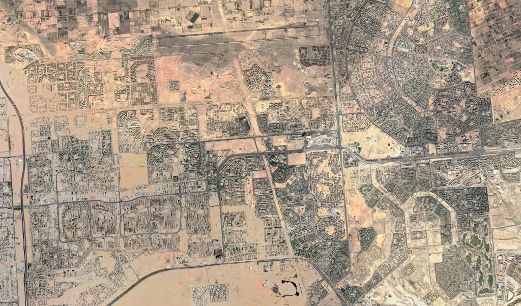
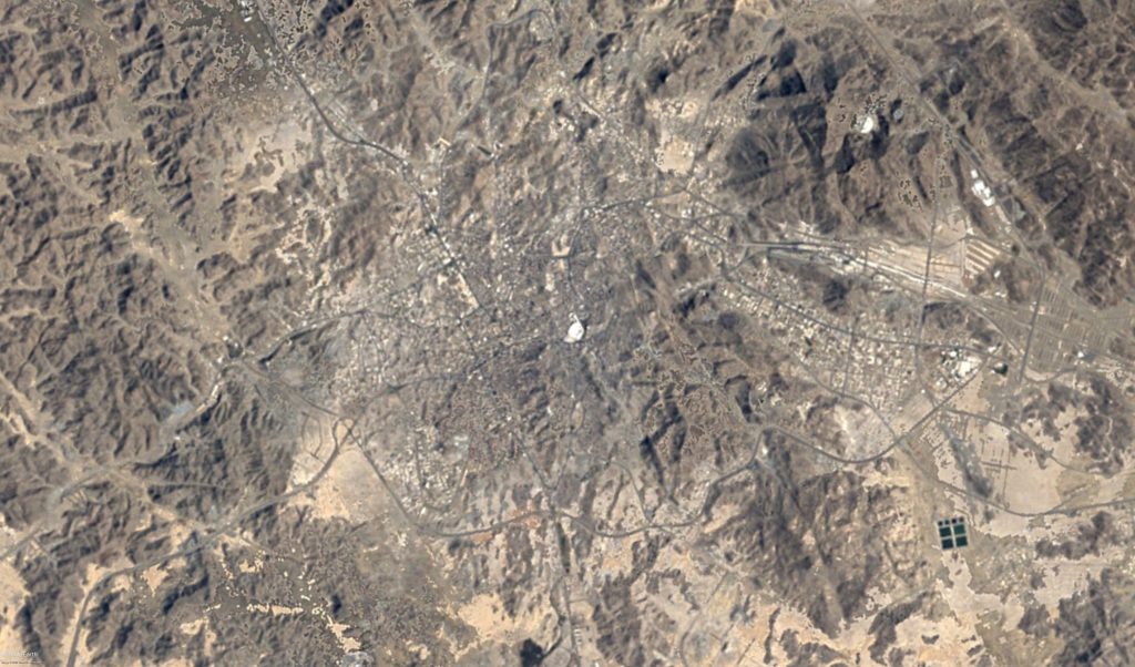
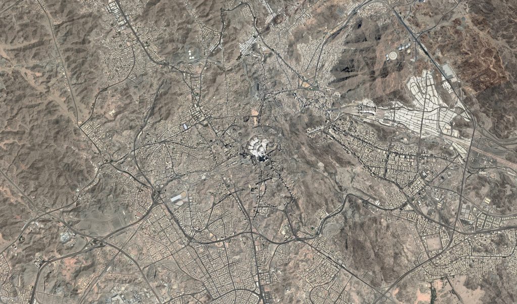
Mecca: The Pilgrim’s City
While in 1921, only 58,584 pilgrims were noted as attending the Hajj, in recent years before COVID-19 restrictions, the holy city of Mecca had been attracting up to 2.5 million pilgrims. To accommodate this massive increase in pilgrims, Mecca has blossomed into a huge city with thousands of hotels and restaurants to cater for this huge influx of people. Even from the 1980s when Mecca hosted around 900,000 pilgrims per year, the changes seen in satellite imagery from then and now, clearly show how this 150 percent increase in pilgrims has transformed the city.
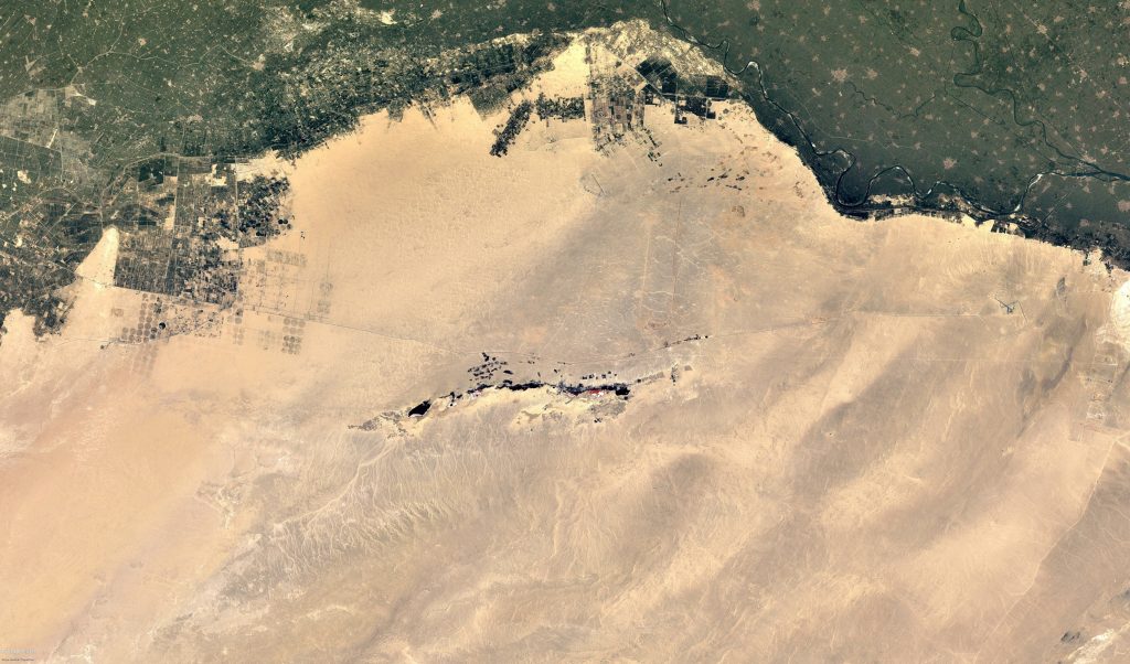
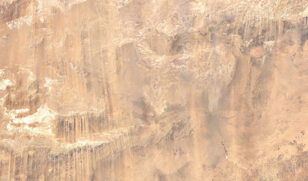
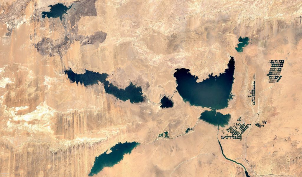
Lake Nasser and the Toshka Project’s Desert Dreams
With water security high on the agenda, Lake Nasser, one of the world’s largest man-made bodies of water, has become an increasingly important reserve of water for Egypt. Fluctuating water levels, the unpredictable implications of climate change, and rising concern regarding Ethiopia’s Grand Renaissance Dam has led to the careful management of Lake Nasser to increase water reserves as much as possible.
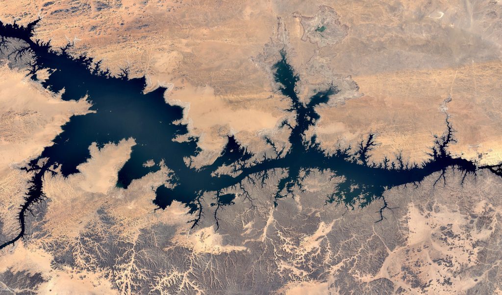
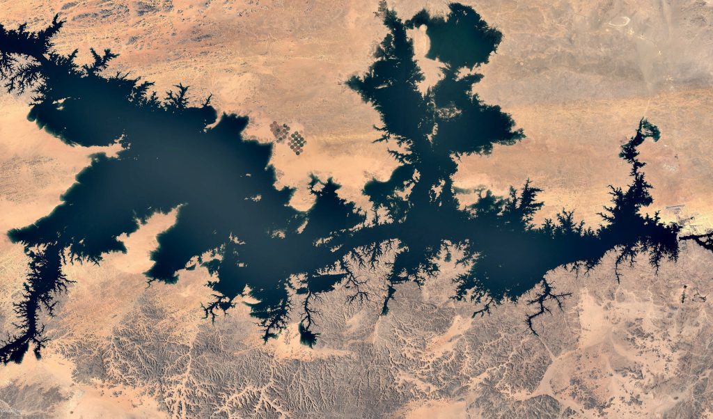
The New Valley Project, more commonly known as the Toshka Project, is an ambitious project by the Egyptian government to use water from Lake Nasser to irrigate parts of the Western Desert to a create a new valley for people to farm, work and live. Having met several hurdles that have considerably slowed the project, the green expenses envisaged are yet to be realised, but several new lakes and circular farms have been established.
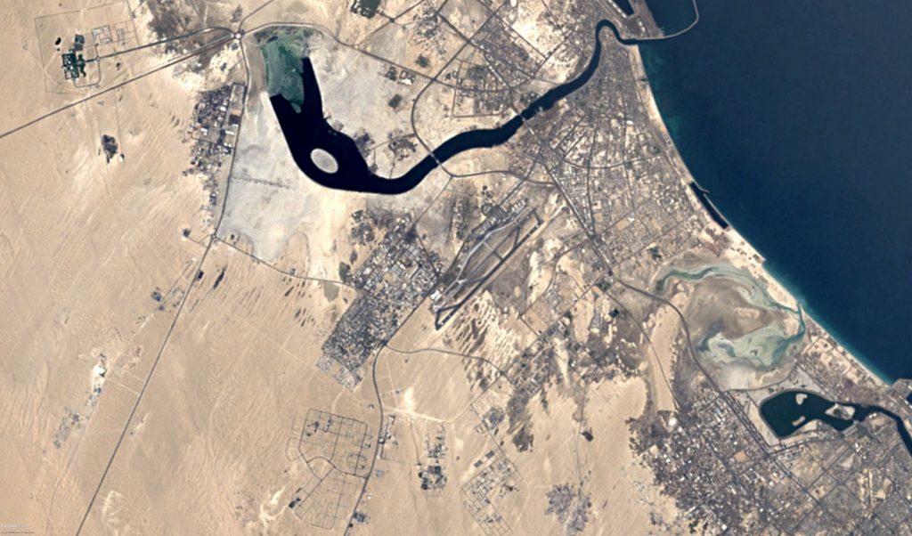
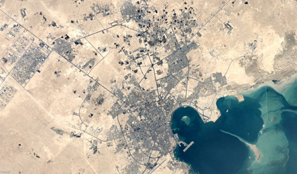
Oil and Development in Qatar’s Doha
Originally a small fishing town famed for its pearl divers, Doha was home to around 14,000 in the 1950s, before growing to 83,000 in the 1970s, and then to a colossal 2.4 million people in 2018. Now housing more than 80% of the whole of Qatar, the ever-expanding city of Doha reflects the importance of the Gulf oil boom for small Gulf states.
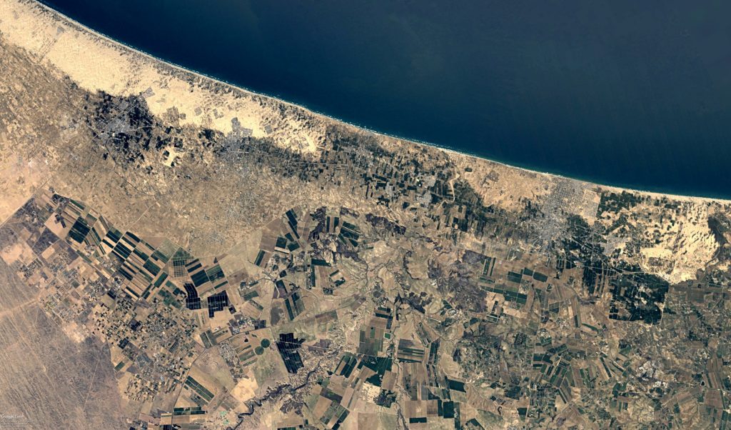
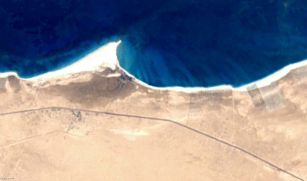
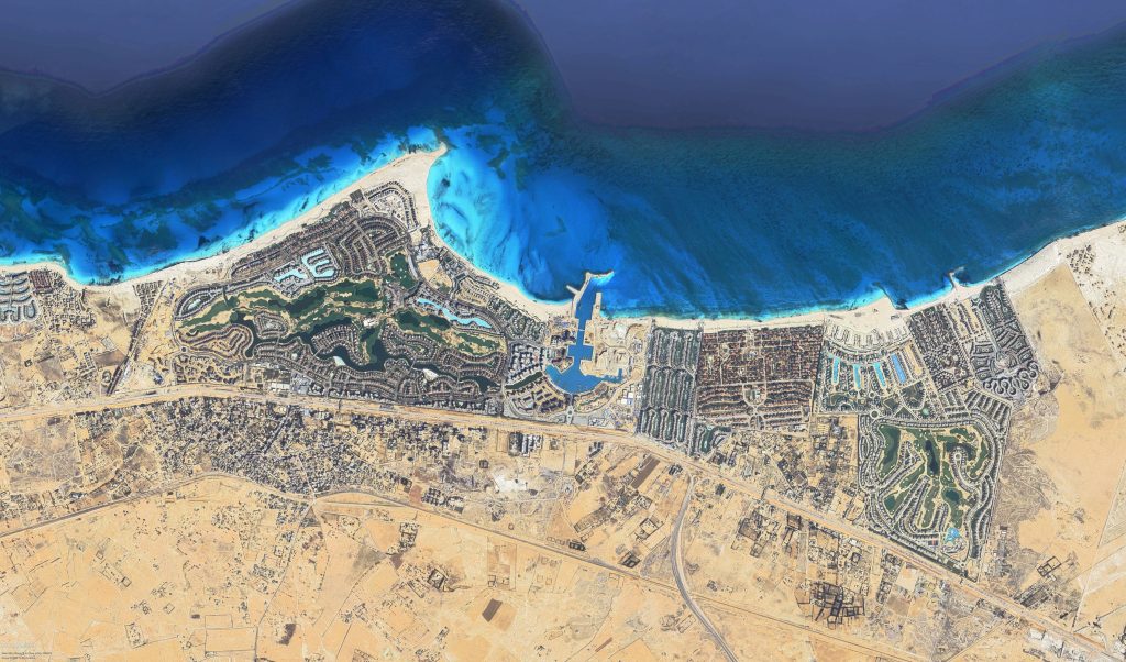
Egypt’s Once Quiet and Simple North Coast
Stories of the old days of the North Coast are now only that, as fancy developments now line the coast almost uninterruptedly from Alexandria to Marsa Matrouh. Every year, new developments spring up, seemingly out of nowhere, like wildflowers next to roads, and the staggering amount of development investment is only set to continue with the establishment of New Alamein City.
WE SAID THIS… Extraordinary Facts About Egypt’s Population